Pilot’s Guide to Class E Airspace
|
Getting your Trinity Audio player ready...
|
You’ll spend most of your flight training time in Class E airspace, whether you are practicing slow flight or stalls in your local training area or heading out on a longer cross-country flight. Class E airspace can often be confusing because it is not clearly marked on the sectional chart (a map pilots use for navigation), unlike the more strictly controlled airspace types like Class B, C, or D. While Class E airspace is considered controlled airspace, meaning it is monitored by air traffic control (ATC), you do not need their permission to fly in it as long as the weather is clear enough to meet basic visual flight rules (VFR).
Since Class E airspace is essentially “everywhere,” it’s crucial to understand its boundaries, particularly the ceiling (top) and floor (bottom). The ceiling of Class E airspace is easy to identify because it always ends at 17,999 feet above sea level (MSL). Above this, you enter Class A airspace, which is used by commercial airliners and other high-altitude flights (and then starts again at FL600/60,000′ if you’re out joyriding in an SR-71).
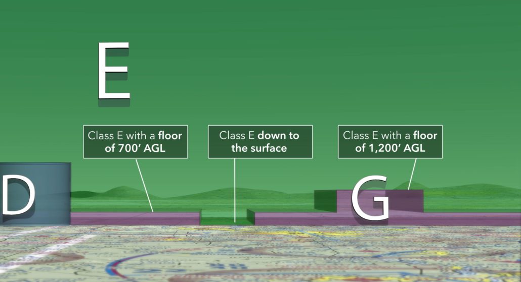
Class E airspace typically doesn’t reach down to the ground. In flat areas (non-mountainous terrain), the lowest part of Class E airspace usually starts 700 feet or 1,200 feet above the ground level (AGL). But how can you know the difference? You can determine this by looking at sectional charts, which provide details about the boundaries of different airspaces.

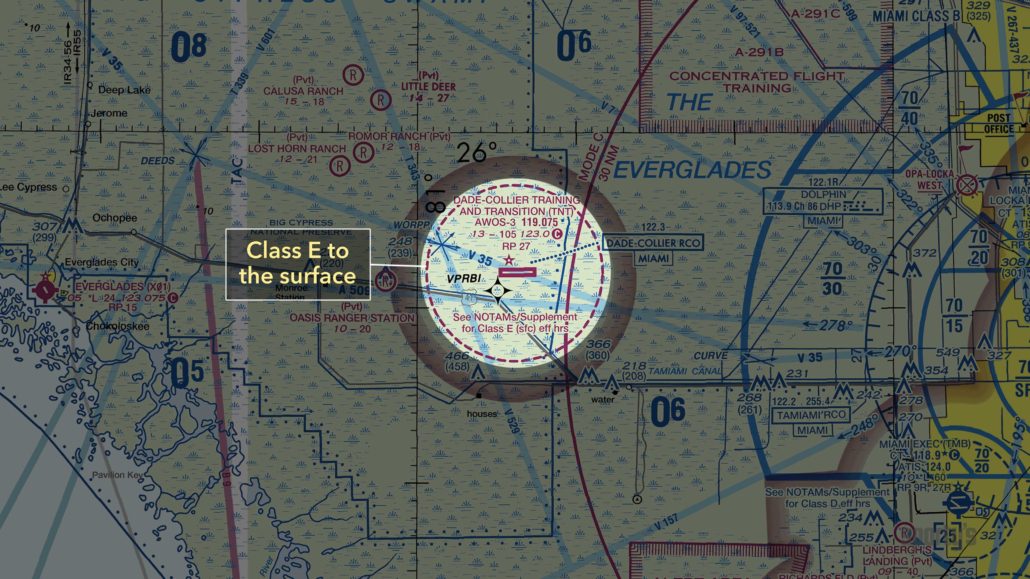
The answer lies within the faded magenta circle that typically surrounds nontowered airports. In the example above, the floor of Class E is 700′ on the faded side of the border (the airport surface area) and 1,200′ everywhere else. Stay below the floor of Class E airspace and you’ll remain in Class G airspace and take advantage of the less restrictive cloud clearance and visibility minimums.

Speaking of weather requirements, here’s a summary of the minimum cloud clearance and visibility required to operate in Class E airspace:

As with all things in aviation, there are many exceptions to the standard conventions. Here are some examples of Class E floor variations found throughout the US.
In this case, Class E extends to the surface, as identified by the dashed magenta line/box appearing adjacent to the Class D airspace:

In some cases, the surface area for an airport is designated as Class E airspace, which is identified by the dashed magenta line/circle around the airport:

Next, let’s review Class E airspace around federal airways. In this example around Victor 120, Class E airspace starts at 1,200′ AGL inside the blue feathered area and extends all the way to the Class A airspace above. The areas outside of the hard edge of the blue line are Class G airspace from the surface to 14,500′ MSL, and then Class E above that:

For additional airspace review, check out our airspace quiz and see how well you know the entire airspace system. You may also find this video on Class E airspace classification helpful. And for complete training on the entire National Airspace system plus much more, check out Sporty’s Learn To Fly Pilot Training Course.
- Quiz: How Does The Body React To Flight? - July 8, 2024
- Pilot’s Guide to Class E Airspace - July 1, 2024
- Quiz: Flying The Traffic Pattern - May 28, 2024


The article could have been better written.
“While Class E airspace is considered controlled airspace, you do not need an ATC clearance to fly in it.”
Many times the weather at my 3500-foot MSL surface class echo airport is below Class E minimums but just beyond the Class E airspace it’s great VFR and an ATC clearance is required. If you are arriving at or departing from an airport marked with surface class echo airspace and the weather is less than a 1000 foot ceiling and/or less than 3 miles, then an ATC clearance is required to fly in that Class Echo airspace.