Quiz: Planning with a VFR Sectional Chart
1 min read


An aviation VFR Sectional chart is chock-full of visual reference information that is important for every pilot. Runway lengths, obstacle avoidance, restricted airspace, plus much more all provide bits of data that will keep you informed and safe on every flight. Do you know these charts front and back, or will that data overload leave you short on answers?
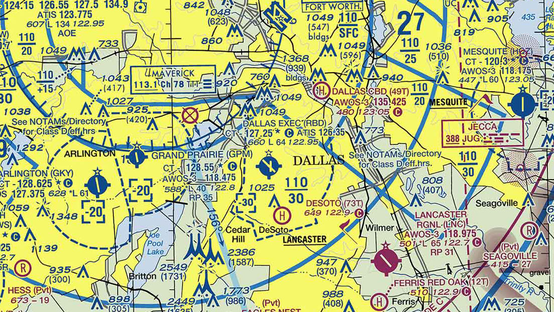
If Dallas Executive Tower is not in operation, which frequency should be used as a Common Traffic Advisory Frequency (CTAF) to monitor airport traffic?

Correct!
Wrong!
For information about the glider operations at Kalispell Airport, refer to

Correct!
Wrong!
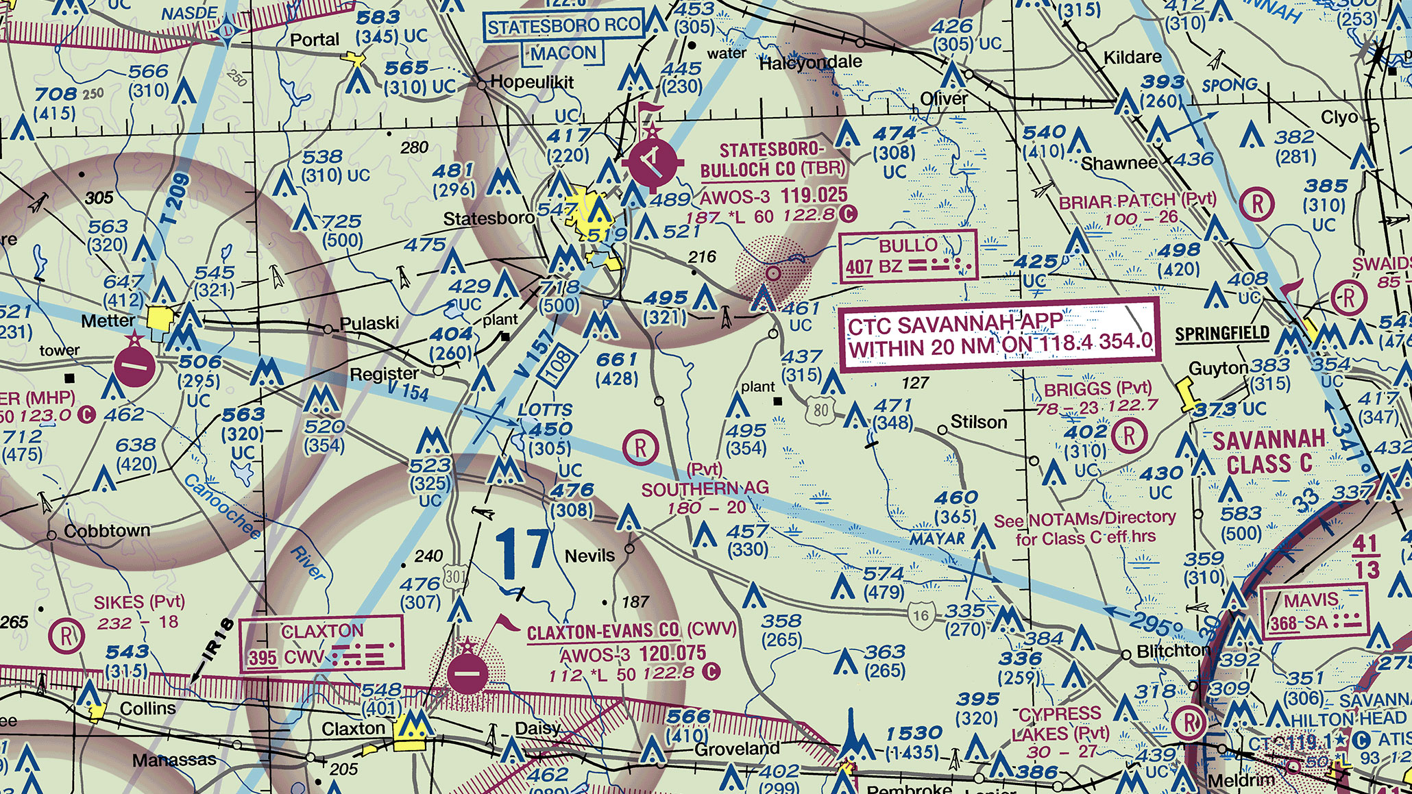
The flag symbols at Statesboro Bulloch County Airport and the Claxton-Evans County Airport are

Correct!
Wrong!
Which public use airports depicted are indicated as having fuel?

Correct!
Wrong!
What is the height of the lighted obstacle approximately 6 nautical miles southwest of Savannah International?

Correct!
Wrong!
What minimum altitude is required to fly over the Cedar Hill TV towers in the congested area southwest of Dallas Executive Airport?

Correct!
Wrong!
The elevation of the Chesapeake Regional Airport is

Correct!
Wrong!
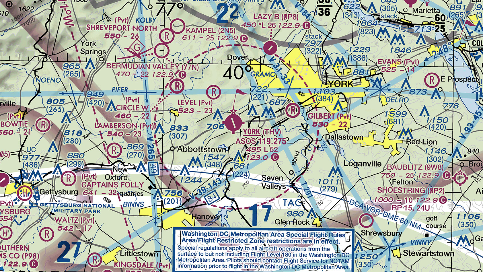
Identify the airspace over York Airport.

Correct!
Wrong!

VFR Sectional Chart
You got out of 8 right!
Want to brush up on your flight planning skills? Check out Sporty’s 2024 Learn to Fly Course
Latest posts by Chris Clarke (see all)
- Quiz: Wake Turbulence Avoidance - July 7, 2025
- Quiz: Airplane Weight and Balance - June 9, 2025
- Mastering the approach and landing: A quiz for pilots - May 13, 2025


