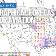
FAA Continues Transition to Graphical Forecasts for Aviation
|
Getting your Trinity Audio player ready...
|
The FAA has announced the next step in its ongoing effort to modernize aviation weather products by further transitioning from traditional area forecasts (FAs) to the Graphical Forecasts for Aviation (GFA) tool. This change, detailed in an Information for Operators (InFO 25004) dated April 8, 2025, reflects the FAA’s strategy to provide pilots with more accurate, accessible, and visual weather information.
Area forecasts, once a primary source of low altitude en route weather planning, have been gradually phased out in the contiguous US since 2017. The latest update expands that transition to include area forecasts for Alaska, the Caribbean, and the Gulf of Mexico.
The GFA tool, available through the Aviation Weather Center, presents weather data in an interactive, time-based graphical format. It allows pilots to view ceilings, visibility, precipitation, winds, turbulence, and more—all layered on a dynamic map to enhance situational awareness.
All pilots are encouraged to become familiar with the GFA, which is recognized as a valid source of preflight weather information under §91.103.
Read the full FAA InFO here (PDF)
- Sporty’s Launches 2026 Learn to Fly Course with Advanced AI Tools and New Flight Maneuver Training - October 22, 2025
- Sporty’s Most Frequently Missed Test Questions—Summer 2025 - September 26, 2025
- Webinar: Pilot Hiring Trends and Insights with James Onieal - September 19, 2025


Leave a Reply
Want to join the discussion?Feel free to contribute!